The Top Walking and Hiking Trails in American Samoa
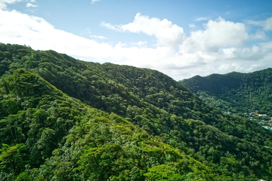
American Samoa offers some of the most spectacular and diverse walking and hiking experiences in the Pacific, from well-maintained trails through pristine rainforest to challenging treks leading to secluded beaches and ancient cultural sites.
Our comprehensive guide covers the best trails across the territory, including the renowned paths within the National Park of American Samoa where you'll discover lush tropical landscapes, dramatic coastal views and unique wildlife encounters. But we don't stop there. We've also included lesser-known gems beyond the park boundaries that lead to remote but stunning beaches, fascinating historical sites like ancient star mounds, and hidden waterfalls that few visitors ever experience.
Whether you're seeking a leisurely stroll through accessible nature trails or an adventurous hike to off-the-beaten-path destinations, American Samoa is one of the best destinations for hiking for every level of walker and hiker.
This article is based on real on-the-ground research, not on AI scraping old content from the internet. Learn how we use AI!
Table of Contents
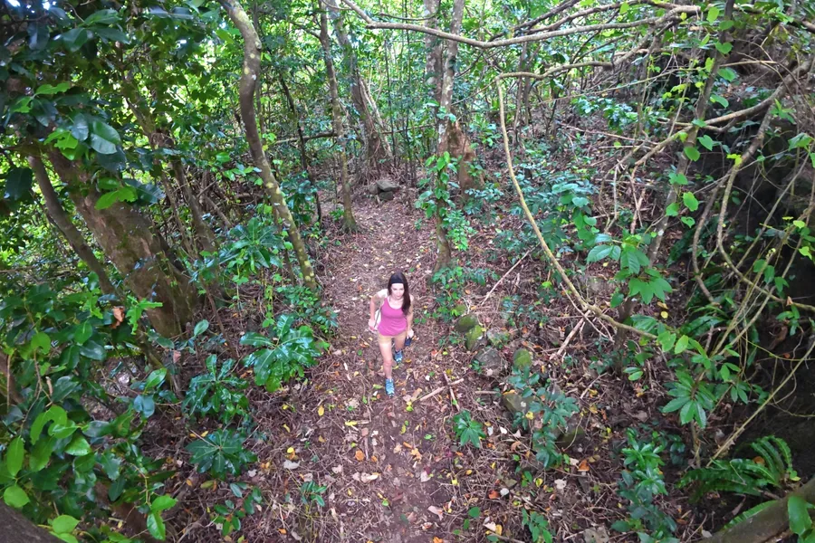
Essential Hiking Tips for American Samoa
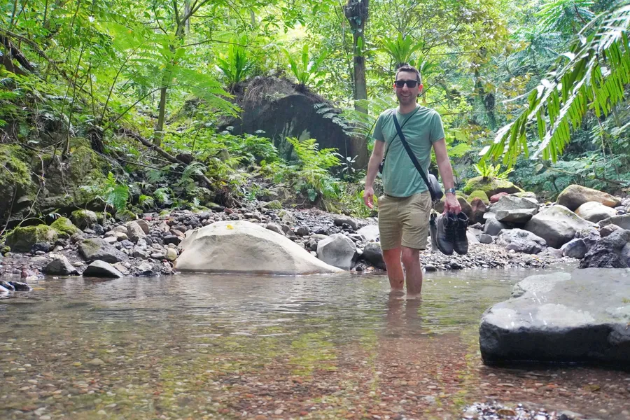
Hiking in American Samoa's tropical climate and rugged terrain is quite different from what you might be used to back home. From our own experience exploring these incredible trails, we've learned a few essential tips that'll help make your adventure both safe and unforgettable.
- Always carry your phone. You'll want that lifeline in case of emergencies, and the coverage is surprisingly good on most trails.
- Be honest about your fitness level. These trails can be more challenging than they appear, so don't bite off more than you can chew.
- Share your hiking plans with someone. Let a friend or family member know your route and expected return time—it's just good sense.
- Bring a hiking buddy along. Not only is it safer, but you'll have someone to share those breathtaking views with.
- Pack plenty of water and snacks. The humidity will have you drinking more than usual, and you'll need the energy boost.
- Stick to marked trails. Wandering off-path isn't just dangerous, it can damage the delicate rainforest ecosystem that makes these hikes so special.
- Watch where you step. The trails here are a mix of rock, dirt and roots that can catch you off guard if you're not paying attention.
- Expect muddy, slippery conditions. These are rainforest trails, after all, so embrace the mud (and pack accordingly).
- Take extra care on steep sections. You'll find ropes installed on the trickiest bits—use them!
- Be mindful of unstable slopes. Landslides can shift the trail unexpectedly, so stay alert to changing conditions.
- Show respect when passing through villages. Many trails cross village land, and the locals are incredibly generous in allowing access—a simple wave and "Talofa" goes a long way.
- Bring at least a gallon of water for demanding hikes. For something like the Mt. Alava Trail, you'll be grateful for every drop.
- Don't fly your drone in the national park.
For more general but essential safety tips for American Samoa, be sure also to check out the American Samoa Safety Tips: Is it Safe to Travel to American Samoa?
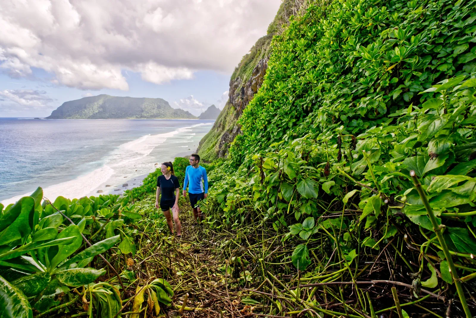
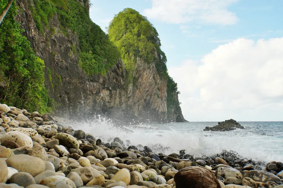
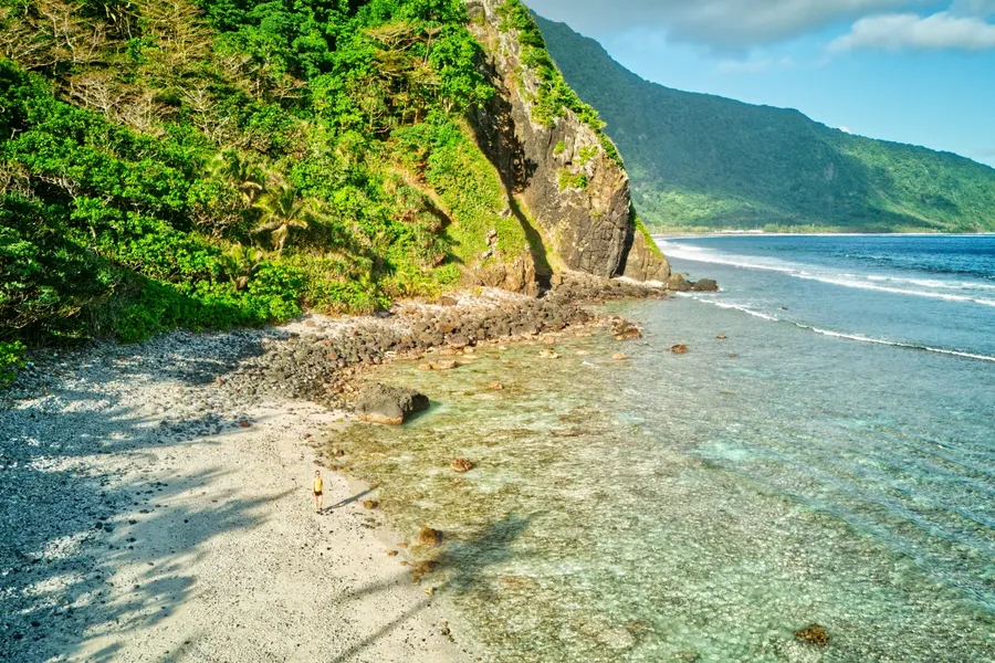
1.Oge Beach Trail (2-3 Hours Return)
A must-do hike in Ofu-Olosega in the Manu'a Islands, the Oge Beach Trail is a diverse hike with wildlife seemingly around every corner.
The trail traverses the shoulder between Mata'ala Ridge and Maga Point, where boobies and frigate birds soar overhead, before descending to emerge at the remote coral rubble beach facing Ta'ū. Once you reach the trail's end, turn left and walk 200 m (219 yards) down the beach to discover a magnificent stretch of sand.
The adventure continues as a scenic beach walk to Leala Point, creating a complete coastal out-and-back adventure. According to our very own editor-in-chief, Laura, this ranks among our favourite walks in American Samoa and the Pacific, with abundant wildlife discoveries awaiting along the way.
Time your visit for low or mid tide, as high tide brings water right up to the trees, making beach access challenging. Allow 2-3 hours to complete the trip (or more if you want to hang out at the beach).
Plus, be mindful that you are indeed following the correct trail - you should always have the coast to your right, not heading way up into the mountains.
The trail can be relatively overgrown in places but the local boys keep the trail chopped for coconut crab hunting.
Olosega Village, Olosega, Manu'a Islands. Follow the main road as far as you can go until it turns into a coastal trail.
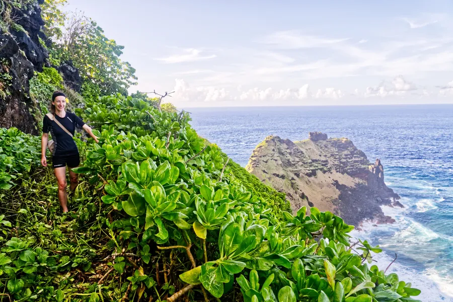
2.Mt Tumu Trail (5 Hours Return)
An iconic viewpoint atop the South Pacific's most striking vistas, Mt Tumu is a Manu'a Islands' must!
This challenging 5.5 km (3.4 mi) ascent through increasingly overgrown terrain offers one of American Samoa's most rewarding hiking experiences. The trail winds past ancient village sites (locals advise quiet respect for the spirits) before reaching a spectacular viewpoint overlooking Ofu Beach, Sunu'itao Peak and Olosega Island.
The steady-paced hike alternates between flat sections and uphill climbs, taking approximately 2 hrs 30 mins to reach the scenic lookout. Pink ribbons and markers help navigate fallen trees and overgrown vegetation, though a local guide from Ofu Village is highly recommended for less experienced hikers - ask around or your accommodation host.
Long trousers are essential for the grass-covered initial section, and the trail becomes easier on the legs after the first stretch.
An alternative route leads to the TV relay tower at the 494 m (1,621 ft) summit, though the main viewpoint offers superior scenery.
Ofu Village, Ofu Island. 4WD trail begins down the dirt road just north of the wharf. Alternatively, guides will take shortcuts.
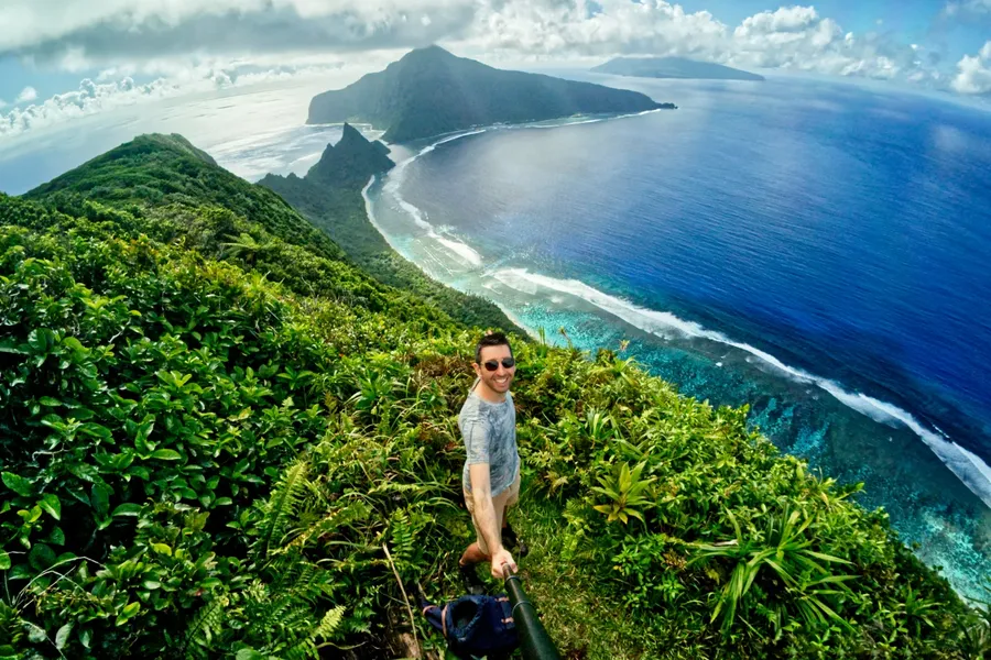
3.Mt ‘Alava Trail (3 hrs 30 mins–4 hrs 30 mins Return)
Fitiuta Lodge
from US$175/night
Adventurous travellers seeking panoramic views and rainforest exploration will find the Mt 'Alava Trail an unmissable hiking experience on Tutuila.
This 7 mi (11.3 km) one-way trail climbs steadily from Fagasa Pass up to the summit of Mt 'Alava (note that the last few steps to the summit are currently closed due to storm damage), which towers above Pago Pago Harbor with breathtaking views of the island's rugged coastline and central valleys.
The trail follows a ridgeline through lush tropical forests and restoration zones where native trees are being reintroduced. Along the way, you'll pass old communication towers and likely spot native birds circling overhead.
The path is well-defined but steep in places with limited shade, so pack plenty of water, bug spray and sun protection. Needless to say, it's best done in the morning for cooler temperatures.
Fagasa Pass (Route 005), Pago Pago, Tutuila. Trailhead signposted from the road. Follow the gravel road behind the interpretation panels to start the trail.
4.Mt ‘Alava Adventure Trail (4–5 Hours Loop)
For the ultimate physical and adrenaline-pumping challenge, tackle the combined Upper Sauma Ridge and Vatia Trail; the Mt 'Alava Adventure Trail represents the most demanding test in the National Park of American Samoa.
This 5.6 mi (9.2 km) loop takes hikers along steep ridgelines, through dense jungle and up a series of 56 ladders and 783 steps, all leading to the summit of Mt 'Alava (at least when the summit is open, as it recently suffered from storm damage) with jaw-dropping views over Pago Pago Harbor and Tutuila's northern coast.
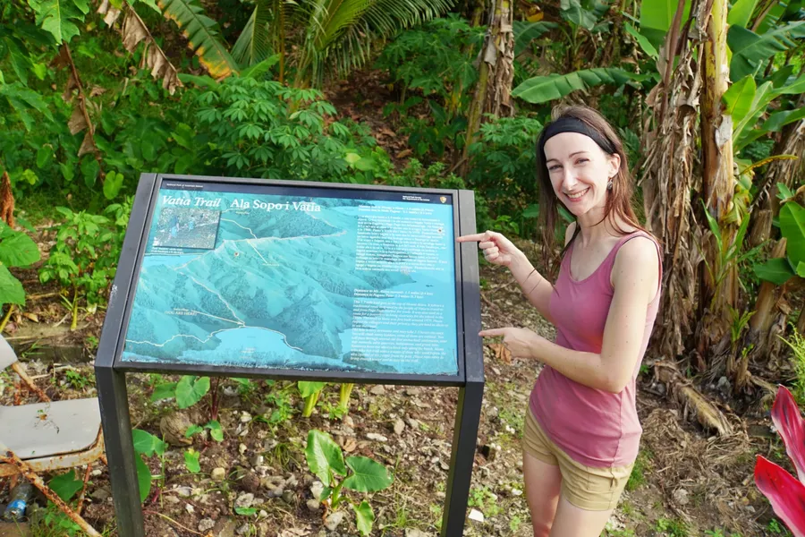
Unlike the standard out-and-back trail, this route continues down to the village of Vatia, looping through more rugged and remote terrain.
Sections of the trail can be narrow, muddy and physically demanding, especially after rain, so it's only recommended for experienced hikers with proper gear.
Once you reach Vatia village, where you'll seemingly emerge in someone's back garden, but that's Ok, return to where you parked along the road.
According to the National Park's Superintendent’s Compendium, the Vatia village part of the trail should not be walked on Sunday to respect the local customs.
Route 006, Amalau Bay, east side of Tutuila. The easiest trailhead to find is the Upper Sauma Ridge Trail, located opposite the Lower Sauma Ridge Trail roadside car park/Pola Island lookout. Look for the wooden ladder across the road.
Editor's Choice
North Shore Tours
Discover Tutuila your way with our personalised half-day adventure! Rather than cramming you into a one-size-fits-all tour, we craft each excursion around your interests and abilities, even if...
5.Blunts Point Trail (10-15 Minutes One Way)
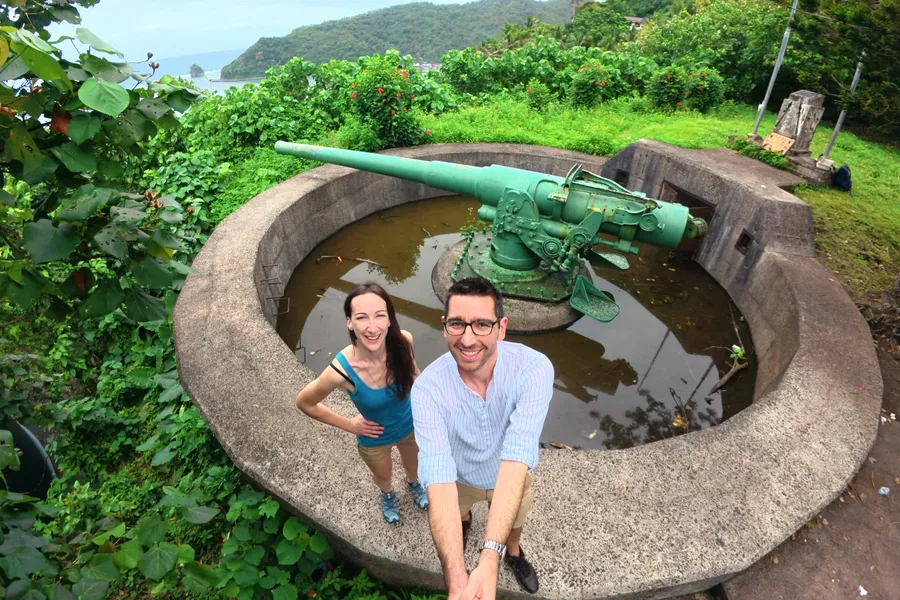
The Blunts Point Trail offers a fascinating journey through World War II history, featuring two massive gun turrets positioned at scenic viewpoints overlooking Pago Pago Harbor.
This uphill forest hike takes you up a wide and well-defined gravel road that gradually ascends past a water tank.
The first viewpoint rewards hikers with stunning harbour views and the opportunity to explore one of the huge WWII guns up close. A short continuation up some stairs, also built during WWII, leads to the second gun turret positioned in the forest, offering even more impressive historical features engulfed by nature.
For those wanting to extend their historical exploration, the trail connects to the broader WWII Heritage Trail, as outlined in the 15 Best Walks in American Samoa. Be prepared for mosquitoes.
Route 001, Fagatogo, Pago Pago, Tutuila. The trail is signposted and begins behind the laundromat.
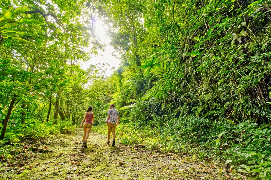
6.WWII Heritage Trail (1 hr 20-1hr 40 mins One Way)
North Shore Tours
from US$100
This scenic trail offers one of the most accessible aerial views of Pago Pago Harbor while scouting out archaeological and WW2 elements.
This 4.8 km (3 mi) roundtrip adventure connects the Blunts Point Gun Battery to the historic Aerial Tramway Site, all while winding through lush tropical rainforest where native bird songs provide the soundtrack to your journey through history.
The trail takes approximately 2 hours to complete with an elevation gain of 279 m (915 ft), leading past remarkable World War II installations built to protect American Samoa from Japanese invasion. You'll discover the Blunts Point Magazine, Utulei South Gun Emplacement, and Blunts Point Cannon and Construction area, along with remnants of cable rail, fighting positions, foxholes and foundations of former barracks and offices.
The final section features steep ladders and rope-assisted steps, culminating at the former tramway site that once transported visitors to Mt 'Alava's summit.
Two trailheads: Route 018, Pago Pago, Tutuila (Signposted up the hill behind the Executive Building, Library, etc.). Or Route 001, Fagatogo, Tutuila (From the Blunts Point Gun Battery Trail behind the Laundromat).
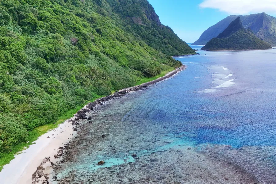
7.Aunu'u Island Trail (1 Hour Return)
%20CREDIT%20AmericanSamoaPocketGuide.com-900x600.webp?v=2026-06-27T01%3A07%3A43.455Z)
Escape to the untouched beauty of Aunu'u Island for a unique and peaceful walking adventure.
This flat, 3-4 mi (5-6 km) round-trip walk takes you past the serene Pala Lake to a secluded beach where dramatic coastal cliffs feature a stunning natural rock archway.
The 2-3 hour-long trek offers breathtaking views of Tutuila Island and the rare opportunity to experience true remoteness; you'll encounter only a handful of friendly villagers along the way.
At the far eastern end of the island, Sina & Tigilau Cliffs are not only a stunning natural attraction but a site steeped in legend.
The "trail" is an official road, so it is easy enough to follow on foot, although some areas reportedly get overgrown towards the eastern side of the island.
Since there are no facilities on the island, you'll need to bring your own food, water and supplies for the journey. The adventure begins with a short boat ride from Auasi, where captains typically wait at the marina for passengers.
Aunu'u Island, accessible by boat from 'Au'asi Marina, east side of Tutuila. Note there is a small fee for the boat transfer.
8.Pola Island Trail (5–45 Minutes Return)
Tucked away in the National Park of American Samoa, the Pola Island Trail offers ramblers a perfect mix of accessibility and adventure, delivering stunning coastal views and dramatic landscapes in a compact and manageable stroll.
Located on Tutuila, this brief coastal walk leads you through lush coastal vegetation to a rocky beach encompassing views of the rugged coastline and Pola Island, a protected sanctuary for nesting seabirds.
The trail begins after you pass the last house in Vatia Village and continues along a gravel road, suitable for high-clearance vehicles if you want to park as close to the end of the trail as possible.
You'll pass interpretation panels before arriving at the rocky cove.
Taking 30-45 minutes return for the full gravel road walk, or 2-5 minutes return from the end of the gravel road, this nature walk is perfect for those with limited time but still looking for a real slice of American Samoan beauty.
Note that the powerful currents here pose a real risk to swimmers. We'd strongly recommend staying out of the water at this beach.
Vatia Village, Tutuila. Trailhead located just past the last house at the northern end of the village (or you can drive most of the trail on the gravel road).

Where to Stay
Fitiuta Lodge
Oceanview Ali'i Suite
US$175/night
9.Lower Sauma Ridge Trail (15–20 Minutes Return)
Good Time Golf
from US$285
Nestled along Tutuila's northern coastline, the Lower Sauma Ridge Trail offers an incredible combination of natural beauty, historical highlights and breathtaking panoramic vistas that make it an essential experience.
Taking around 15-20 minutes to complete at 660 yards (600 m), the one-way trail is moderately challenging with a gentle incline, perfect for a quick adventure with a big payoff.
At the start of the trail, you'll find interpretive panels highlighting the area's cultural significance, flora and fauna.
March downhill through the forest and over a stony path to an ancient star mound, an archaeological site used in traditional ceremonies and navigation.
The trail ends with stunning views over the Vai'ava Strait National Natural Landmark, with Pola Island visible in the distance; an iconic, narrow rock formation and nesting site for seabirds.
Route 006, Amalau Bay, north coast of Tutuila. Just off the main road between Afono and Vatia. There is trail signage, a fale and roadside parking.
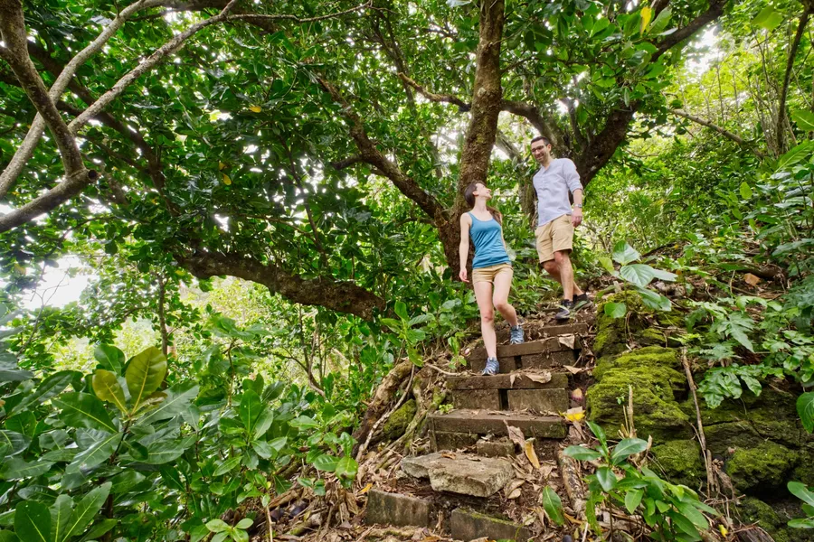
10.Tuafanua Trail (2–3 Hours Return)
For those seeking a challenging rainforest escape, the Tuafanua Trail offers an invigorating trek through lush vegetation and dramatic coastal cliffs, concluding at a secluded beach paradise.
This 2.2 mi (3.5 km) return trail starts at the northern end of Vatia Village on Tutuila, winding through dense vegetation before descending via steep ladders and ropes to a secluded rocky beach.
Though short in distance, this trail is challenging due to its terrain. Expect slippery paths, narrow ridgelines and overgrown sections. You'll want proper footwear, water and a downloaded map - just in case, as signage can be minimal.
The trail is well worth the effort, however, as it ends at a quiet, wave-battered beach. Strong currents make swimming unsafe, but the setting is perfect for a rest and photos.
As always, it's best to start early and to hike with others for safety. Allow 2-3 hours to complete.
Vatia Village, northern coast of Tutuila. The trailhead is at the northern end of the village, behind the extravagant red building, just before the Pola Island gravel road trail begins.
11.Saua Trail/Si’u Point Trail (2–3 Hours Return)
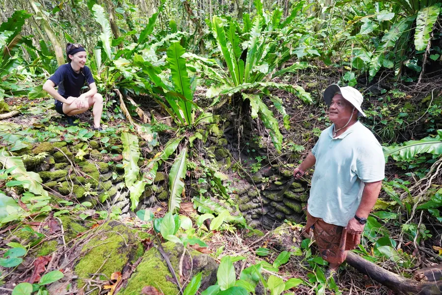
For those craving cultural discovery and untouched island vistas, the Saua Trail (Si'u Point Trail) on Ta'ū Island delivers a tranquil coastal adventure winding through forest and ancient historical sites.
This 5.7 mi (9.2 km) out-and-back trail (or, more appropriately, road) begins just beyond the last homes in Fiti'uta Village and follows the southeastern coast of Ta'ū.
The road winds through coastal vegetation, leading past the ancient village site of Saua, which is also believed to be the birthplace of Polynesian culture - you can learn more about it in the 10 Best Historical Sites in American Samoa.
Remnants of the village can be seen at various stone wells and grinding stones situated on the roadside, so keep an eye out as they're easy to miss.
You'll also have the opportunity to stop by various picturesque beaches, such as Luo Ma'a, meaning "Two Rocks", and Pu'a Vai, named after the springwater found in the area. The latter beach is also our favourite for snorkelling.
At the trail's end, you'll reach the remote Aufotu Cove, where rocky headlands meet the vast Pacific. It's best to take a guide if you want to venture along the coast to the Luifuta Waterfall.
Though the route is relatively gentle, the distance and heat can make it moderately challenging, so come prepared with plenty of water, sun protection and good shoes.
As always, we recommend starting early to avoid the midday heat. Allow 3 hours minimum to complete the hike, although you can easily spend longer with stops for swimming and revelling in nature's paradise.
Fiti'uta Village, Ta'ū Island, Manu'a Islands. Start by continuing down the road south of Fitiuta village.
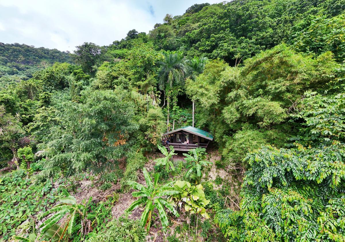
12.Fatifati Auala Trail (3–5 Hours Return)
Hidden Hibiscus
from US$100/night
Steeped in history and offering an arguably more interesting trek to Mt 'Alava Summit from Fagasa Pass, the Fatifati Auala Trail stands out as one of American Samoa's most rewarding hiking experiences.
This rugged rainforest trail on Tutuila winds uphill along an ancient path, featuring rope-assisted sections, steep ridgelines and sweeping viewpoints.
Starting near the Mt 'Alava area, the trail starts squished beside a high-wire fence before breaking away from civilisation.
It climbs for approximately 3 km (2 mi) through dense jungle to the Fagaloa Viewpoint, taking approximately 2-3 hours return, with the option to continue onward to the summit of Mt 'Alava to make it around 5 hours return.
Along the way, hikers encounter archaeological sites, including a traditional star mound and a historic village. In other words, look out for flatter areas which would have served as foundations for these sites.
The trail is arguably more interesting than the main Mt 'Alava Trail if you’re into archaeology, since you’ll see these features almost as soon as you enter.
Fagasa Pass (Route 005), Pago Pago, Tutuila. Same trailhead as Mt 'Alava, which is signposted from the road. Follow the narrow trail alongside the fence.

Editor's Choice
Good Time Golf
Tee off on American Samoa's only 18-hole championship course with stunning ocean views and rugged mountain backdrops. We'll pick you up from your hotel, the cruise port, or airport in our...
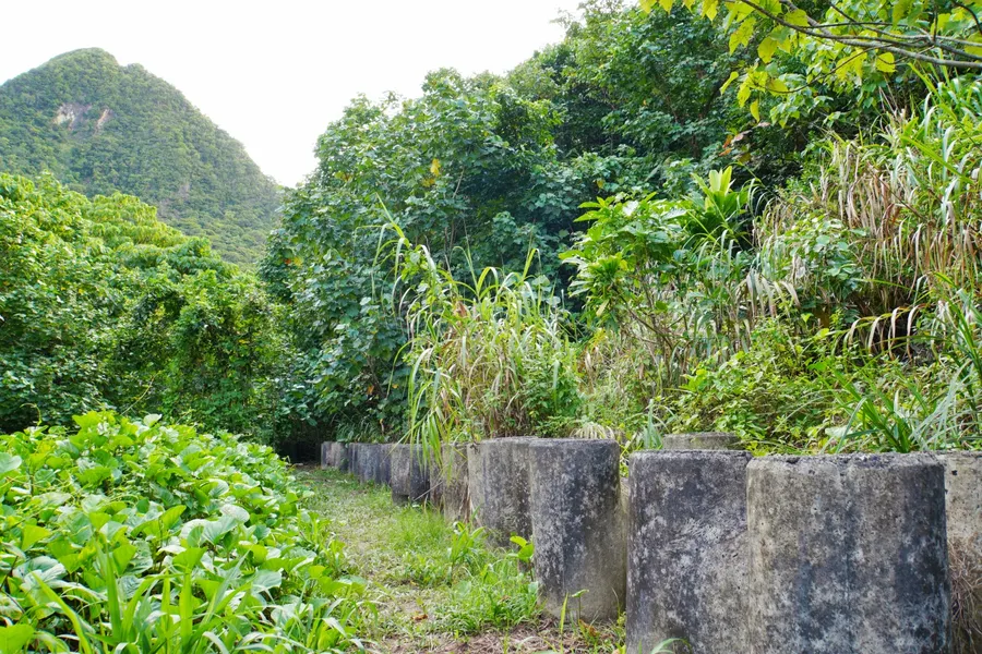
13.Sili Village Trail (40 Minutes - 1 Hour Return)
A flat walk with a mix of natural wonders and historical intrigue, the access road to the long-abandoned Sili Village is a worthwhile mission.
The journey begins with a scenic 20-minute walk from the main road to reach the former village site, where concrete housing structures now stand as haunting reminders of the past, slowly being reclaimed by tropical vegetation.
From the initial village ruins, it's another 25 minutes to reach a dramatic rocky coastline, perfect for those who love rugged natural landscapes. For beach lovers willing to venture further, an additional 30 to 40 minutes of hiking leads to pristine sandy shores that feel completely untouched.
The village was evacuated in 1981 due to devastating waves, creating an eerie yet captivating atmosphere that tells the story of nature's power. The well-maintained road allows access via high-clearance vehicles, making this hidden gem accessible to various types of explorers.
Route 020, Sili, Olosega, Manu'a Islands. From the bridge (on Olosega), take the gravel road to the left (north of the island).
14.Olosega Tsunami Evacuation Road (1 Hour One Way)
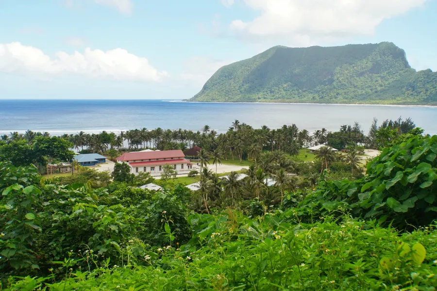
When the village of Olosega is not using this as a vital evacuation route in case of a tsunami (fingers crossed), the Olosega Tsunami Evacuation Road actually makes for a glorious walk.
Transforming a practical emergency route into an unforgettable hiking experience, this 4WD track heads uphill from the back of the village, providing breathtaking panoramic views that showcase the entire settlement below, including the charming village church, pristine beach and the neighbouring island of Ofu in the distance.
The hour-long walk begins at the village's water tower, where you'll follow the gravel road to the left as it climbs steadily along the cliffside. The well-defined path makes navigation straightforward, whilst the gradual ascent ensures the hike remains accessible to most fitness levels.
You can loop back through the peaceful village streets, adding an extra 10-20 minutes to explore the local community and soak up the authentic island atmosphere.
Tsunami Evacuation Road, Olosega Village, Olosega, Manu'a Islands. The water tank turnoff from the main road is located about 130 yards (120 m) south of the Olosega Taufusi sign.
15.Tula Observatory Walk (20 Mins Return)
Adventures Unlimited
from US$75
Certainly one of American Samoa's best-maintained walks, the Tula Observatory is less of a "trail" and more like a set of steps all the way down to the easternmost point of Tutuila.
Perched atop the sealed Fagasa Road, this National Oceanic and Atmospheric Administration (NOAA) facility offers visitors a unique glimpse into weather monitoring and climate research (though access requires advance coordination by calling (684) 258-2848). Even if the observatory itself isn't accessible, which is fairly common, the journey is absolutely worthwhile for the stunning hibiscus gardens alone.
The real adventure begins with the wooden stairway descent of 178 steps (plus one charmingly broken step) leading down to Tutuila's rocky eastern shore. From this dramatic vantage point, you'll enjoy sweeping views stretching all the way to the Pola Islands along the northern coastline, making it one of the island's most spectacular and secluded viewpoints.
Fagasa Road, Tola, east side of Tutuila. Follow the sealed Fagasa Road all the way to the end.
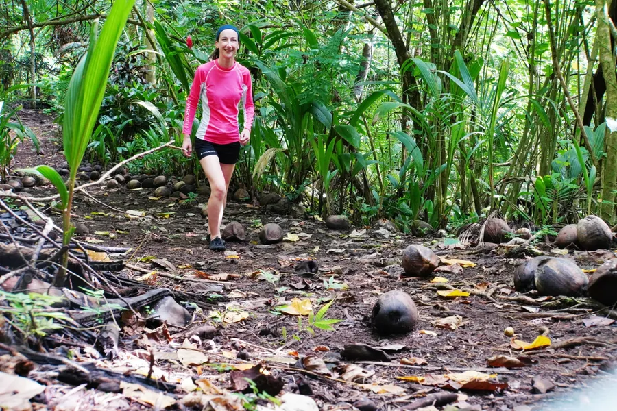
16.Nu'uuli Waterfall Walk (30 Mins Return)
A diverse but easy-to-follow trail (once you find the trailhead), the Nu'uuli Waterfall Walk rewards ramblers with an awesome swimming hole at its culmination.
The surrounding rainforest creates a natural amphitheatre that muffles the sound of the 20 m (66 ft) cascades, making this hidden gem feel worlds away from the nearby commercial strip.
The 15-minute walk/scramble through lush tropical vegetation over mostly well-formed trails adds to the adventure, leading you across several stream crossings before revealing this spectacular cascade and natural pool.
It's polite to ask permission from locals if you see someone at the nearby house, though you're not usually charged an entry fee.
The relatively easy access, combined with the dramatic setting, makes this one of American Samoa's most rewarding waterfall experiences.
Nu'uuli, west side of Tutuila. Signposted along Route 001 beside Family Mart. Follow the road all the way to the end and go left at the fork (i.e. not the road into someone's garden). Park at the grassy clearing before the waterworks. Cross the shallow stream here to the formed trail at the quarry on the other side.
Where to Stay
Hidden Hibiscus
Cabin
US$100/night
17.Le'ala Shoreline (30-40 Mins Return)
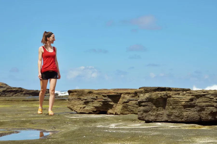
Only accessible from the Taputimu end of the "walk" (despite what online maps suggest), the Le'ala Shoreline trail is actually a jaunt along a magnificent piece of coastline.
After a leisurely 15 to 20-minute stroll, you'll discover some fantastic tidal pools that are perfect for hanging out, paddling about, or taking a refreshing swim.
Timing is everything here. For the tidal pools, low tide is your best bet, as we've found from our own experiences. The Sliding Rock, should you want to try this nature waterslide, is a different story entirely—mid-tide tends to work better, but here's where local knowledge becomes invaluable.
According to locals, it's absolutely essential to chat with the kids or other visitors already there before attempting the Sliding Rock. The waves can crash straight onto the reef, creating some serious safety concerns that change throughout the day.
Otherwise, we personally recommend visiting to enjoy the beach and to walk along the shoreline.
Route 003, between Vailoatai and Taputimu, west side of Tutuila. When approaching from Vailoatai, drive past the sign that says "No Swimming On Sunday" and take the next driveway right. There is a sign for the car park here. A small fee applies if there's someone there to take it.
18.Fagatele Bay (20 Mins Return)

Worldwide Car Rental
from US$110
While most know Fagatele Bay for its magnificent beach and marine sanctuary, the forest walk to get there is also worth it for travellers looking for a short outing (although you'll probably want to stay at the beach for a while).
This pristine bay is home to Tutuila's last remaining coastal rainforest, where dramatic cliffs slope directly into waters teeming with marine life.
The sanctuary is thought to harbour 200 species of coral, 1,400 species of algae and invertebrates, and 271 species of fish, making it a vibrant underwater paradise where sea turtles are frequently spotted gliding through the colourful reef systems. Snorkelling is good on a calm day. The best coral displays are beyond the waves if the conditions allow.
The adventure begins with a scenic forest trail accompanied by birds and coconut crabs as you navigate the rim of the ancient volcanic crater. After about 10 minutes, you'll reach a wooden staircase to a secluded beach.
Access costs US$10 per person, paid directly to the landowner who maintains the trail; simply call out or knock on their door to arrange entry.
Route 120, Fagatele Bay, west side of Tutuila. Signposted from the main road. From Futiga Village, follow Route 120 all the way to the house at the end of the road. Take the road to the right of this house and continue to the next house (if the gate is open). Pay your fee at the house and, if you have a high-clearance vehicle, follow the dirt road to the start of the trail.
19.Sunu'itao Peak Base Trail (20-30 Minutes One Way)
A coastal escapade at the end of the beautiful Ofu Beach, the Sunu'itao Peak Base Trail is where mountain meets ocean, literally, with you in the middle of it.
Starting from the far eastern end of Ofu Beach, this unique trail requires timing your visit with low tide as you navigate a fascinating mix of volcanic rocks and tiny sandy beaches.
The 20-30 minute scramble takes you along the dramatic coastline to Asaga Beach, positioned directly under the bridge connecting Ofu and Olosega islands. The slow-paced journey allows you to fully appreciate the pristine marine environment and dramatic cliff formations that make this corner of the Pacific so special.
You can create a loop by returning via the road, adding just another 15 minutes to your adventure and offering completely different perspectives (and easier walking) of this stunning landscape.
Route 020, Ofu, Ofu Island, Manu'a Islands. The far eastern point of Ofu Beach.
20.Matafao Peak Trail (3 Hrs 30 Mins - 5 Hours Return)
Challenge yourself with a demanding trek to Matafao Peak, one of American Samoa's designated National Natural Landmarks that promises an unforgettable adventure for experienced hikers.
This rugged mountain, though shorter than the famous Mt 'Alava, presents its own formidable obstacles with two exposed ridges, two open clearings and an overgrown, narrow trail that tests even seasoned trekkers.
The humidity here is relentless and will be your greatest adversary, making this hike significantly more challenging than the elevation might suggest. Navigation becomes tricky due to the overgrown conditions, which is why hiring a local guide isn't just recommended, it's essential for your safety.
While technically possible to attempt solo, the challenging terrain and rescue operations that occasionally occur make professional guidance the wisest choice. Come prepared with plenty of water, proper hiking gear and realistic expectations about the demanding conditions you'll face.
Fagasa Pass (Route 005), Pago Pago, Tutuila. Trailhead signposted from the road, directly across the road from the Mt 'Alava Trail. Access is via a ladder.
Editor's Choice
Adventures Unlimited
Discover Pago Pago Harbor like never before on our unique waterbike adventure! Pedal across sheltered waters on innovative twin-hull waterbikes that keep you perfectly stable while we explore...
21.Massacre Bay Trail (4 Hours Return)
%20CREDIT%20AmericanSamoaPocketGuide.com-900x600.webp?v=2026-06-27T01%3A07%3A43.675Z)

Maliu Mai Beach Resort
from US$160/night
The Massacre Bay trail is not within the national park boundaries, but it still offers an unforgettable journey through some of Samoa's most remote and historically significant terrain for those who can find a guide.
This challenging hiking trail offers an unforgettable journey through some of Samoa's most remote and historically significant terrain.
Starting from the isolated village of A'oloaufou, the four-hour (4 km/2.5 mi) return trek leads you to the even more remote A'asau, where just one family calls this pristine location home.
The trail culminates at the hauntingly beautiful Massacre Bay, a site steeped in tragic history from 1787, when a violent skirmish between French sailors and Samoan villagers claimed 51 lives.
Due to the challenging and sometimes unreliable trail conditions, hiring a local guide from A'oloaufou village is essential for both safety and to fully appreciate the cultural and historical significance of this remarkable journey.
A'oloaufou, west side of Tutuila. Start from the community garden.
More About Walks in American Samoa
That's it for our guide to the best walks and hikes in American Samoa. For more information about exploring American Samoa, check out the following articles:
- 10 Best Walks & Hikes in American Samoa National Park
- The Top 10 Natural Wonders in American Samoa
- 10 Best Swimming Spots in American Samoa
Finally, if there's anything we've missed, you're likely to find it in our The Complete Travel Guide to American Samoa.

%20CREDIT%20AmericanSamoaPocketGuide.com-900x600.webp?v=2026-06-27T01%3A07%3A44.551Z)